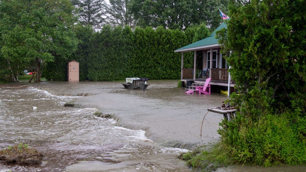
MORGAN –– Vermont’s Northeast Kingdom was hit by another wave of severe flooding early Tuesday morning, causing widespread damage and prompting numerous rescues across several counties. This event comes just weeks after the region was devastated by earlier flooding.
The National Weather Service in Burlington reported that slow-moving storms dropped between 3 to more than 8 inches of rain over parts of the NEK overnight. This led to the declaration of two separate flash flood emergencies near St. Johnsbury and Morgan.
In St. Johnsbury, the Fairbanks Museum and Planetarium recorded 7.96 inches of rainfall, marking the highest single-day total in their 130 years of weather records. The town experienced significant road damage, with sections of Memorial Drive, Route 2, and Route 5 closed due to flooding. Local businesses, including Morrison’s Feed Bag, suffered severe damage and inventory losses.
Lyndonville and East Lyndon were particularly hard hit. Fire Chief Jeff Corrow reported that parts of East Lyndon were completely cut off due to road and bridge washouts. Swift water rescue teams had to use creative methods, including ladders and excavators, to reach stranded residents. Several homes were destroyed, including one resident’s tiny home that was swept away by the flood waters.
In East Burke, residents woke to find several inches of water in their yards, with many homes cut off from roads due to washouts. Town Administrator Jim Sullivan noted that the storm impacted the entire east side of town, causing significant damage to bridge abutments.

Morgan was also severely affected. The area received at least 5 inches of rain, leading to significant flooding. Vermont Route 111 was closed in multiple sections, from VT 114 to old McAve Road due to high water, and from Waterstreet/bridge 8 to the fishing access area, also due to high water.
Other communities in the region also faced road closures. In Brighton, Vermont Route 105 was closed from Lakeshore Drive to Ethan Allen Drive due to a washout. In Canaan, Vermont Route 102 at Bridge 18 over Keyer Brook, south of Canaan Hill Road, was reduced to one lane.
The Passumpsic River was expected to crest at nearly 17 feet, considered moderate flood stage, potentially causing more flooding in riverside communities.
Vermont Emergency Management reported that ten swift water rescue teams were dispatched to the area overnight, conducting approximately two dozen rescues in Caledonia and Essex counties.
The flooding also impacted infrastructure beyond roads. In St. Johnsbury, a portion of the newly completed Lamoille Valley Rail Trail appeared to have been washed away. Utility crews were working to clear downed electric lines in various locations.
As communities begin to assess the damage, weather forecasts indicate the potential for more storms. The National Weather Service warned that additional isolated storms and downpours could result in more flooding and strong winds.
State officials are reminding residents to take basic safety precautions, including turning off electrical power in flooded areas, moving to higher ground if water is rising near homes, and testing water for contamination after flood waters recede.


